Fantastic Dobongsan Mountain
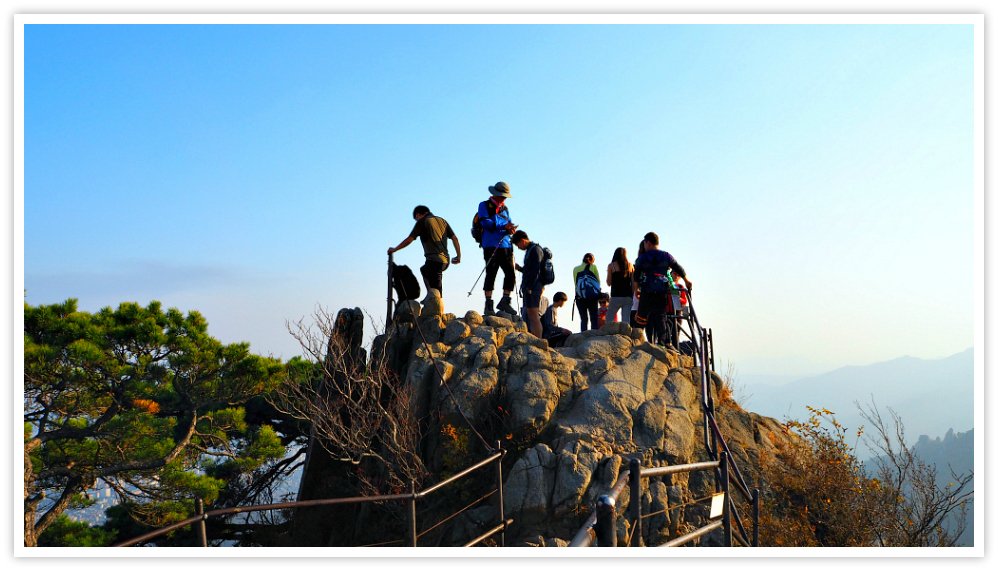
 One of Dobongsan Mountain's highest peak - Jaunbong Peak
Introduction
Welcome to Seoul, a vibrant metropolis where modernity and nature coexist harmoniously. Amidst the bustling cityscape, there is a hidden gem waiting to be discovered – Dobongsan Mountain. Rising majestically on the northern outskirts of Seoul, Dobongsan Mountain offers a thrilling adventure and a respite from the urban hustle and bustle.
As you venture into the heart of Dobongsan Mountain, you'll find yourself immersed in a world of natural wonders. The mountain's rugged peaks, lush forests, and winding trails beckon outdoor enthusiasts, hikers, and nature lovers to embark on an exhilarating journey. Strap on your hiking boots, breathe in the crisp mountain air, and prepare for an unforgettable experience.
Dobongsan Mountain is a hiker's paradise, boasting a network of well-maintained trails that cater to different skill levels. For the adventurous souls seeking a challenge, the main trail leading to the mountain's summit promises a thrilling ascent.
As you ascend the steep slopes, the verdant foliage provides a refreshing backdrop, and the distant cityscape slowly fades away, replaced by panoramic vistas of rolling hills and picturesque valleys.
Along the trails, you'll encounter hidden gems and natural wonders that will leave you in awe. Waterfalls cascade down rocky cliffs, creating a symphony of soothing sounds, while tranquil streams meander through moss-covered rocks, inviting you to cool your feet and find serenity in nature's embrace. The vibrant flora and fauna add bursts of color to the landscape, showcasing the resilience and beauty of the mountain's ecosystem.
At the summit of Dobongsan Mountain, a breathtaking reward awaits. As you reach the pinnacle, you'll be greeted by panoramic views that stretch far and wide, showcasing the sprawling cityscape of Seoul on one side and the pristine wilderness on the other.
The sense of accomplishment and awe at the grandeur of the surroundings is unparalleled, leaving an indelible memory that will stay with you long after you descend.
Beyond its natural splendor, Dobongsan Mountain is also steeped in history and spirituality. Temples and shrines dot the mountainside, offering a glimpse into Korea's rich cultural heritage. One notable temple is Cheonchuksa, a Buddhist temple nestled amidst the serene landscape, where you can witness monks engrossed in meditation or participate in serene temple ceremonies.
Dobongsan Mountain is more than just a hiking destination; it is a sanctuary where you can reconnect with nature, find solace in its quietude, and revel in the awe-inspiring beauty that surrounds you. Whether you're an avid hiker, a nature enthusiast, or simply seeking an escape from the urban jungle, Dobongsan Mountain promises an adventure of a lifetime, where the spirit of Seoul meets the majesty of Mother Nature.
So lace up your boots, pack your sense of wonder, and let Dobongsan Mountain unveil its secrets as you embark on an unforgettable journey in the heart of Seoul.
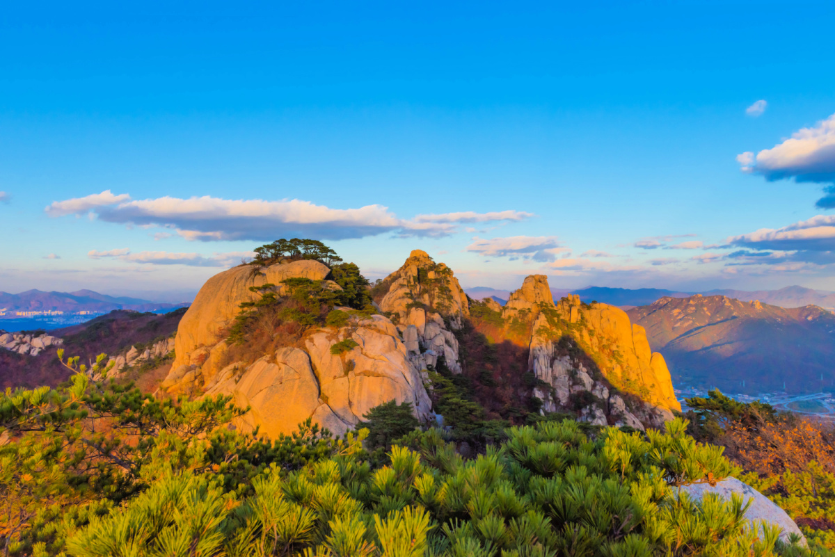
 A beautiful view of Dobongsan Mountain in Seoul, South Korea.
Meeting Dobongsan Mountain
Dobongsan Mountain, my favorite mountain, is located in Seoul. I love it because it is simply majestic, and its beauty varies according to the season.
It is one of the natural blessings accessible at the heart of the city. It is a symbol and representative mountain of Dobong District from which the district is named from.
Its peaks are the gems of Dobong Mountain. Among many peaks or summits, there are four of them that are more popular...
- Manjangbong (718 meters high)
- Seoninbong (708 meters high)
- Obong (660 meters high)
- Jaunbong (739 meters high)
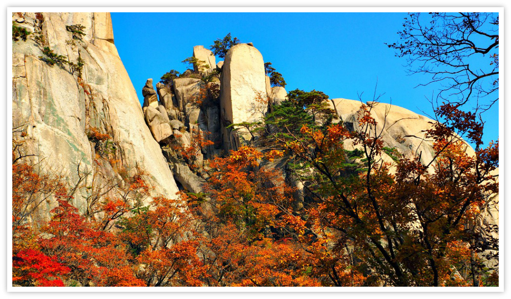
 The colorful and fiery leaves of Autumn's maple leaves attract people and visitors of all ages and origins
For a quick Korean language lesson (if you don't know it yet), the ending syllable "bong" means 'peak' in English. Yes, that's right!
So, Dobongsan Mountain offers fantastic scenery of thick forests, valleys, rocky peaks, streams, and interesting rock formations. It is even said that the area around Dobongsan Mountain is one of the better places in Seoul to view fall foliage.
Additionally, some of Korea's famous and historical temples can be found here. All in all, it's truly a great spot for an adventurous outing!
Whether you're looking for a hike, want to explore nature, or just take in the views, Dobongsan Mountain is definitely a great place to visit. So if you ever find yourself in Seoul, take a day trip to Dobongsan Mountain and enjoy the adventure!
Happy exploring!
And don't forget: bong means peak! :)
FACT CHECK: Due to its beauty and accessibility combined, Dobongsan Mountain welcomes some 10 million hikers annually.
Amazing Features of Dobongsan
Dobongsan District was once part of Seoul before it became independent in 1973. Therefore, it is not difficult to understand if I say that Dobongsan Mountain extends the Seoul area.
Part of the mountain extends to Uijeongbu City of Gyeonggi Province, and Jangheung-myeon of Yangju City.
Dobongsan Mountain boasts its grandiose rocky cliffs, beautiful valleys (such as Munsadong, Wondobong, Musugol, and Obong). That scenic somehow resembles the famous scenic sights of Geumgangsan. For that reason, Dobongsan was called Seoul's Geumgangsan in the old days by locals.
Dobong Mountain (note: 'san' means mountain, so you will notice that I sometimes interchange them) is fundamentally composed of solid big rocks and boulders, and high granite rocks that form such fantastic views.
Some rocks look like, some people say, a 'spewing white light high into the sky,' which is the sight you can see due to the whitish color of the granite rocks that the various parts of the whole mountain.
Most of the highest peaks are 'easy' to navigate because they are somehow connected to each other with spine-looking rocks.
Some people describe the connecting rocks like a dragon soaring up towards the sky, while others say they look like a turtle. By the way, both animals are essential, significant symbols in this culture and its dominant religion (Buddhism).
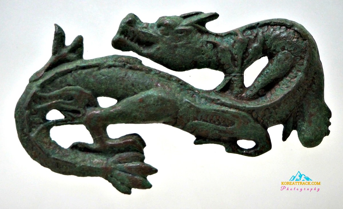
 This carved dragon was crafted during the Goryeo Kingdom, which is a traditional symbol for life, progress, and wealth among locals such as the Buddhism followers (Source: Yonsei University Museum)
As I love movies, I have fantasies of seeing out-of-this-world rock formations when I hike Dobongsan. In my fertile imagination, I can see alien-shaped rocks (like those in Star Wars ^^), dinosaurs, animals, among others. Yes, it is quite entertaining!
Now, if you found this article for some reason, like wanting to learn about this mountain, I am providing you the trails accessible on this mountain.
The trails below are the recommended ones by Dobongsan District Office as they are maintained and safe for hikers. I mean, they are recommended because they offer you great vantage points to scenes and skylines surrounding the area.
Here they are...
Dobongsan Hiking Trails
Main Hiking Trail
Dobong Visitor Center--Bomun Ridge--Dobong Main Ridge--Podae Ridge--Sapae Ridge--Sapaesan Mountain--Angol Park Visitor Center
This trail is 9.8 kilometers and takes around 5 hours to accomplish. Time is relative to the speed of the hiker.
Crossing Hiking Trail
Dobong Visitor Center--Mountain Rescue Unit--Jaunbong Peak--Obong Ridge--Songchunam Ridge--Obong Visitor Center
This trail is 7.6 kilometers long and can take more than 3 hours to complete.
Wondobong District Hiking Trail
Wondobong Visitor Center--Deokjesaem Spring--Mangwolsa Temple--Podae Ridge--Hoeryong Valley--Heoryong Visitor Center
This trail is about 5.8 kilometers long and could take almost 3 hours to accomplish.
Dobong District Hiking Trail
Dobong Visitor Center--Mountain Rescue Unit--Jaunbong Peak--Dobong Main Ridge--Bomun Ridge--Dobong Visitor Center
It is 7.3 kilometers far and could take almost 4 hours to finish the trail.
Songchu District Hiking Trail
Songchu Branch Office--Songchu Falls--Obong ridge--Songchunam Ridge--Obong Visitor Center
This trail is 6.4 kilometers long and could take around 3 hours to accomplish.
Uiam Trail
Dobong Visitor Center--Dobongsa Temple--Bomun Ridge--Cheonjinsa Temple--Uiam Rock
This trail is 2.5 km long and could take 1 hour and 30 minutes to complete the course.
Sinseondae Course
Dobong visitor Center--Dobongseowon Confucian Academy--Dobong Shelter--Seokguram Grotto--Sinseondae Terrace
It is around 3.52 km, and it takes 2 hrs to complete.
Manworam Course
Dobong visitor Center--Gwangnyunsa Temple--Geumgangam Hermitage--Dobong Shelter--Manworam Hermitage--Podae Ridge
This course is about 2.5 kilometers in the distance and could take around 1 hour and 20 minutes to accomplish.
Getting to Dobongsan
Don't worry as there are many ways to get to Dobongsan Mountain area. The cheapest way to get there is by public transports--subway (metro) and bus.
Via Subway (Seoul Metro)
From anywhere you can take a subway, take or transfer to Line 1 or 7, then get off at Dobongsan Station.
Find your exit then cross the main road, and you should see Dobong High School on your left, then Seoul Garden Apartment (and Dobongsan Parking Lot on your right). Continue walking ahead, passing Dobong Eco Park until you see Dobong Visitor Center.
By Buses
Take the Blue bus 141 or 142; Green bus 1127 or 1128 (Ajin Bus Stop)
Because buses could be confusing at times, I suggest, from my experience that you take the Subway. It is easier to find guides in the subway station than on buses.
I hope this is useful. Enjoy your mountain hiking and exploration!
- Home
- South Korea Tourism
- Dobongsan Mountain in Seoul
Get Exciting Activities
Book one of our exciting activities today to experience the thrill of a lifetime! Take advantage of this opportunity and secure your spot in advance.
Hotel Map Guide
Find your affordable, accessible, and comfortable hotel in Seoul at Agoda.Com. See the hotel map below...
Hotel Booking Guide
Find affordable and amazing hotels on Agoda.com using the search box below. Book now to enjoy great discounts and save!


New! Comments
What do you think about this page? Leave me a comment in the box below.